Bing Maps Web Part Overview
 The Modern Bing Maps Web Part provides great functionality for illustrating the geographical location of a building. Whether your are looking to feature a corporate or satellite office, to a location for a particular event, to a meeting location. The web part provides a simple way to visualize where these locations may be.
Powered by the Bing Map engine, users are offered an interactive experience while reading a page or article. Users are allowed to alter the map views, zoom in or out, as well as change the position you are viewing.
By offering different views and perspectives, readers can easily identify a location that you are looking to highlight. By adding a pin and label to the map, you can draw the readers attention to a relevant address.
Key Features
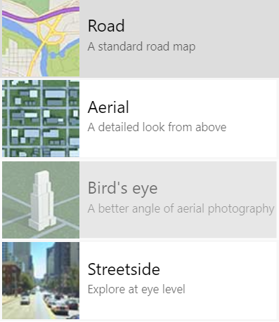
Interactive options when interfacing with the web part:
- Road View: A standard road map. Used by most traditional GPS systems.
- Aerial View: A detailed view from directly above buildings and structures.
- Birds Eye View: A better angle of aerial photography. Renders three-dimensional objects for buildings.
- Streetside View: Explore at eye level. Captures high level detail including landmarks, street sights, and structures.
- Zoom (in): Adjust the focus of the map to include only specific locations.
- Zoom (out): Adjust the focus of the map to include a broad set of locations.
- Click and drag: Navigate vertically or horizontally through the map.
- Scale: A quick reference for distances measured in both Miles and Kilometers
Configurations
| Property | Type | Description |
|---|---|---|
| Address to display | Text | The address to be featured within the map. |
| Show Pin Label On Map | Boolean | Determines whether or not to include a text label with the pinned address |
| Pin Label | Text | The text you want to display with the dropped pin |